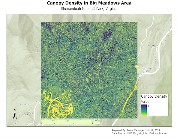
This week we were given a .las LiDAR file with data from the Big Meadows area of the Shenandoah National Park in Virginia. We learned how to decompress .las files, create DEMs from LiDAR, create DSMs from Lidar, and calculating forest height from LiDAR. Tools used were LAS Dataset to Raster, Minus, LAS to Multipoint, Point to Raster, IS NULL, Con, Plus, Float, and Divide. From there, the data gained was used to display 3 maps as seen below.
The first map shows tree heights with a distribution bar graph below it.
The second map is of canopy density.
The third map is a LiDAR elevation map with a LiDAR_Derived DEM below it.
Comments: This week ran smooth with almost no issues that I could tell and becoming more aquainted with everything ArcGIS can do is a plus that will only help me in the future.


No comments:
Post a Comment