Monday, October 25, 2021
Mod 1: Visual Interpretation
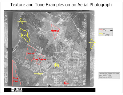
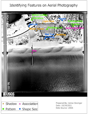
Start of a new GIS Course: GIS 4035 Photo Interpretation and Remote Sensing. This first lab we created 2 maps, the top one showing examples of textures, tones, and the bottom map shows examples of features that can be interpreted by shape or size, shawdow, pattern an association in aerial photos given to us. Seeing how features look on photos can help interpret them to what they are showing. This can be seen in the homes, buildings, swimming pools, piers and even parking lots I chose. They all have distinct characteristics as we have learned this lab that define their identity. Great first introduction assignment executed well!
Subscribe to:
Post Comments (Atom)
GIS Portfolio
The final assignment in the GIS Certificate Program was to create a GIS Portfolio. It went as I expected. It is hard to write about yourself...
-
My GIS Day was a bit lack of luster, but I tried to see what everyone else was doing. I asked my coworkers if they have ever participated an...
-
The journey from a GIS Padawan to now has flown by. The journey to find an internship felt like an eternity of highs and lows. I only just s...
-
This week we covered topics in surface interpolation techniques in GIS, including Theissen, Inverse Distance Weighted (IDW), and Spline. We ...
No comments:
Post a Comment